

Bung Muan is also known as Mount Serembu or Bukit Peninjau. It is a historical and natural landmark located in Bau, Sarawak, Malaysia. It is about 25 kilometers from Kuching. It holds significant historical value, particularly related to the era of the White Rajahs of Sarawak and the famous naturalist Alfred Russel Wallace

Trail Distance and Terrain
The trail to the summit is relatively short, around 2.5 to 3 kilometers one-way.
The summit of Bung Muan stands at approximately 500 meters (1,646 feet) above sea level. While the elevation gain isn’t extreme, the hike is characterized by its steepness.
The path is a natural jungle trail. It is often covered in mossy rocks and exposed tree roots. It can be very slippery, especially after rain. There are sections about mid-way to the summit with moderate steep inclines. Need not worry as there are rope rails to help with the push to the summit.
Hiking Time
Usually, it takes around 2 hours for the extremely fit person. For the average Joe, it takes about 3 hours. I would not worry too much on the time taken, I would suggest as to give oneself 3.5 hours to reach the summit. This is enough time for photo taking and rests.
Suggested itinerary:
- 0700hrs – Meet at Siniawan Old Town for local breakfast.
- 0800hrs – Depart to Donu Peninjau Lama for registration
- 0830hrs – Hiking Starts
- 1130hrs – Reach Summit
- 1230hrs – Descend back to start point
- 1400hrs – Arrive back at Donu Peninjau
- 1430hrs – Late lunch at Siniawan
- ENDS
I would recommend returning to Siniawan for the late lunch. I suggest Premier Food Republic. It has plenty of local stalls offering various dishes.

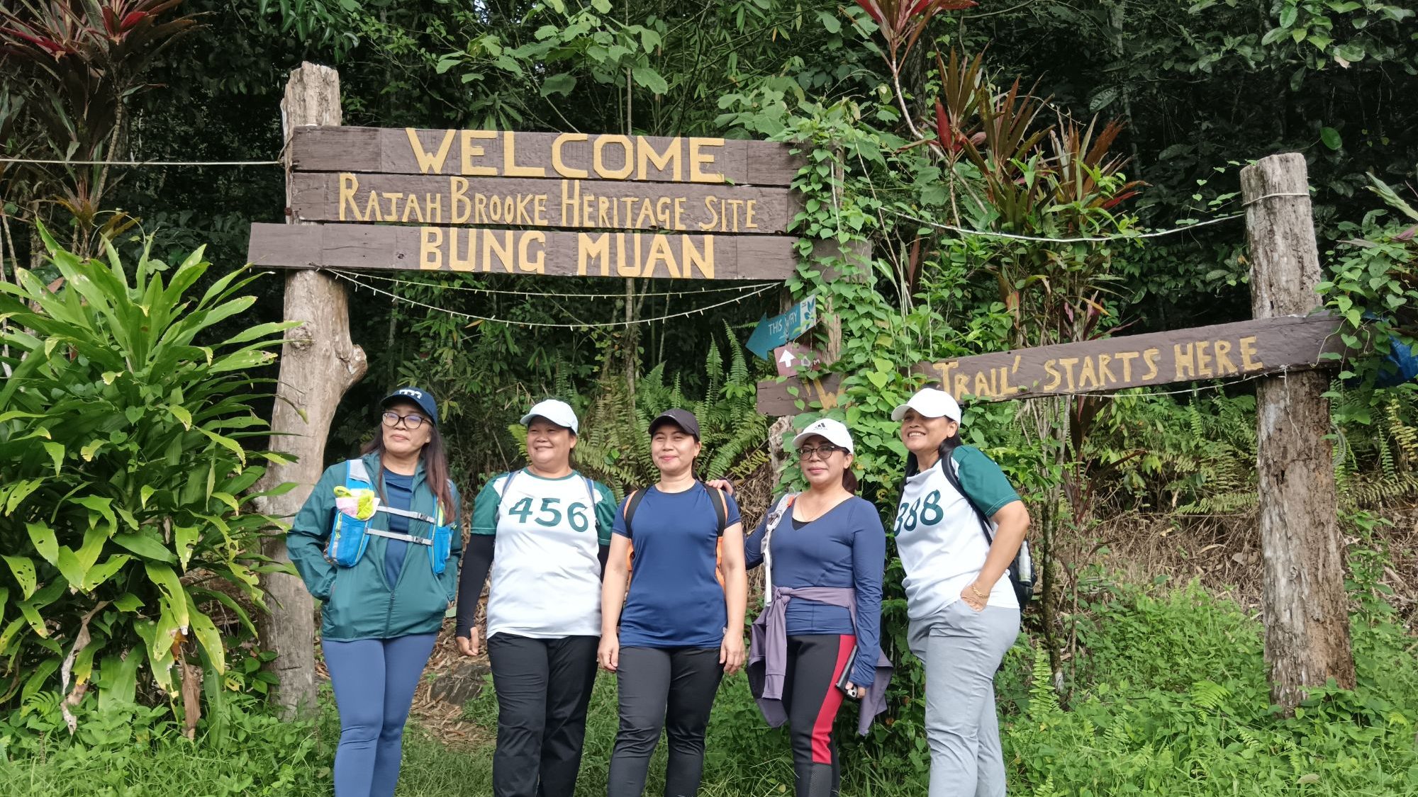
Trail Start Point – Peninjau Lama
The main trail start point is at Donu Peninjau at Kampung Peninjau lama. It is about a 30 to 40-minute drive from Kuching. If you are in a big group, I suggest carpooling as parking space is available but limited.
Location Self drive to Donu Peninjau using Google Maps https://maps.app.goo.gl/mW8He7twkFC8thNp9
Lovely Jungle Trail with Historic Sites
As you begin the hike you will embark on a small foot path and trail is clearly marked using the red and white stripe hazard tape. Be sure to follow the markers and the occasional signages that show the way to summit and the distance travelled. About 600 meters from the start, you will come across the original site where once there was a Bidayuh Longhouse.

The viilages that surround Bung Muan or Mount Serembu like Kampung Peninjau, Podam, Sibulung and Sega can trace their origins back to this site.
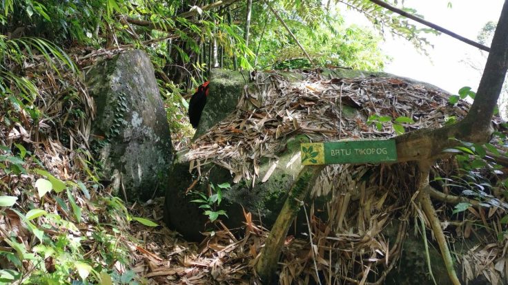
There are other local legends along the trail. One such legend is the Batu Tikopog, a smooth boulder that seemed to be split in two. Legend has it that a long time ago, a warrior from the village became tired of climbing up and down the boulder. He decided to slice it, creating a small pass. He sliced the boulder in two, thus creating a small pass.
The Wallace Connection

Wallace was invited by Brooke. He spent considerable time here collecting specimens. He formulated his groundbreaking ideas on evolution by natural selection independently of Charles Darwin. Knowing that this very landscape inspired such profound scientific thought adds another layer of significance to the hike. While we didn’t stumble upon any new species (alas!), every rustle in the undergrowth and every unique plant we encountered served as a reminder of the incredible biodiversity that Wallace studied here.

Rajah Brooke Cave – Gigantic Boulder Rest Stop

This huge boulder is a natural shelter for all is also a key place for photo taking. Nice cool place to take another 10 minutes rest before continuing your hike to the summit. From here there are two sceenic look out points
One is the Siniawan View Point and another one would be the Podam Bau View Point. My Favourite is the Podam Bau View Point. The view is better in my pinion and a lot more windy and cooling.

From Podam View Point, the hike is now easy and another 30 minutes you would reach the Bung Muan Summit. Enjoy the breath taking view and also that sense of achievement. Bung Muan is not the highest peak in Kuching but it is quite a challenging hike.
The descent back to start point is of course faster. It takes just over an hour to get back to Donu Peninjau.
Tips for Hiking Bung Muan from Peninjau Lama
- Entrance Fees : RM 5.00 per person
- Start early: To avoid the midday heat and allow ample time for the trek.
- Wear appropriate footwear: Sturdy hiking shoes with good grip are essential.
- Bring enough water and snacks: The hike can be strenuous.
- Be prepared for all weather conditions: Rain showers are common in Sarawak.
- Consider hiring a local guide: They can provide valuable insights and ensure you stay on the right path.
- Respect the local culture and environment: Leave no trace and be mindful of the local community.
For a full experience please check out the recent climb i did last August 16, 2025.

Leave a comment